Legacy of the Chief, Chapter 16, Pt 1: "DeHaviland Arrives at Chitina-1923" |
click on picture for larger image: some of these images appear in the book for this chapter. |
buildings and combination log and frame structures, looks very much like it came straight out of a page from the Old West. The small Indian village of Chittyna on the hill to the southwest adds one more element of charm to the rustic western atmosphere. But it is the busy presence of the Copper River and Northwestern Railway which dominates the small town. Until recently Chitina was an important trans-shipment site, with passengers and goods moving from Cordova on the coast, having arrived in the Territory by means of Alaska Steamship, thence to Chitina by train, and finally by way of Orr Stage Lines through Copper Center and on to Fairbanks.  Main Street, Chitina, ~1913 --Cordova Museum President Harding and wife came to Alaska to dedicate the new government railway with the driving of a golden spike at Nenana. Their original plans included taking the Richardson route from Fairbanks to Chitina. Then the Presidential party was to board a special train for the scenic ride to Cordova. After a full day of sightseeing the party would then depart Cordova by way of Alaska Steamship and return to the States. Since Harding canceled this interior Alaska part of the trip in favor of a quick return to Anchorage by rail, then on to Seward and finally Cordova for only a very brief visit, this adventurous traveler decided to take the route, as it was originally planned, to experience what the Presidential party missed. 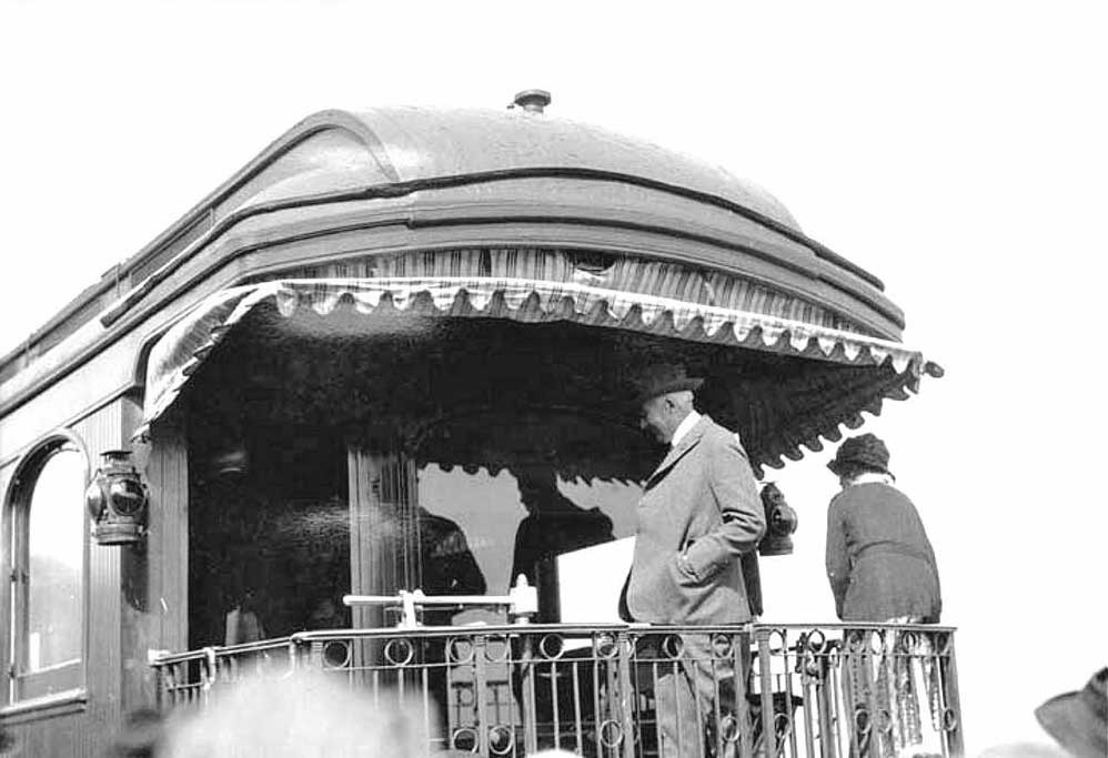 President Harding on AKRR observation car during his 1923 visit to the Territory of Alaska For those of you desiring to take this sojourn from Fairbanks to Chitina or Valdez, be aware that the Richardson Roadway is in most places little more than a rough trail. Much of the roadway is subject to delays due to washouts, slides and other problems with river crossings, such as missing bridges. Mud and tundra are in abundance, as are hoards of mosquitoes. Although the old horse teams have recently given way to modern motor buses, all too often the passengers have to assist in pushing the bus out of the mud bogs which quickly become an all too familiar aspect of the trail. Those inconveniences aside, the trip is nothing if not spectacular as long as one keeps his eyes looking upwards toward the mountains, starting from the very beginning of the journey where one leaves Fairbanks and immediately encounters the panoramic view of the northern slopes of the Alaska Range. One of the most recognizable peaks is Mt. Hayes, which can be seen clearly all the way from Fairbanks to Donnelly, close to the half-way point. 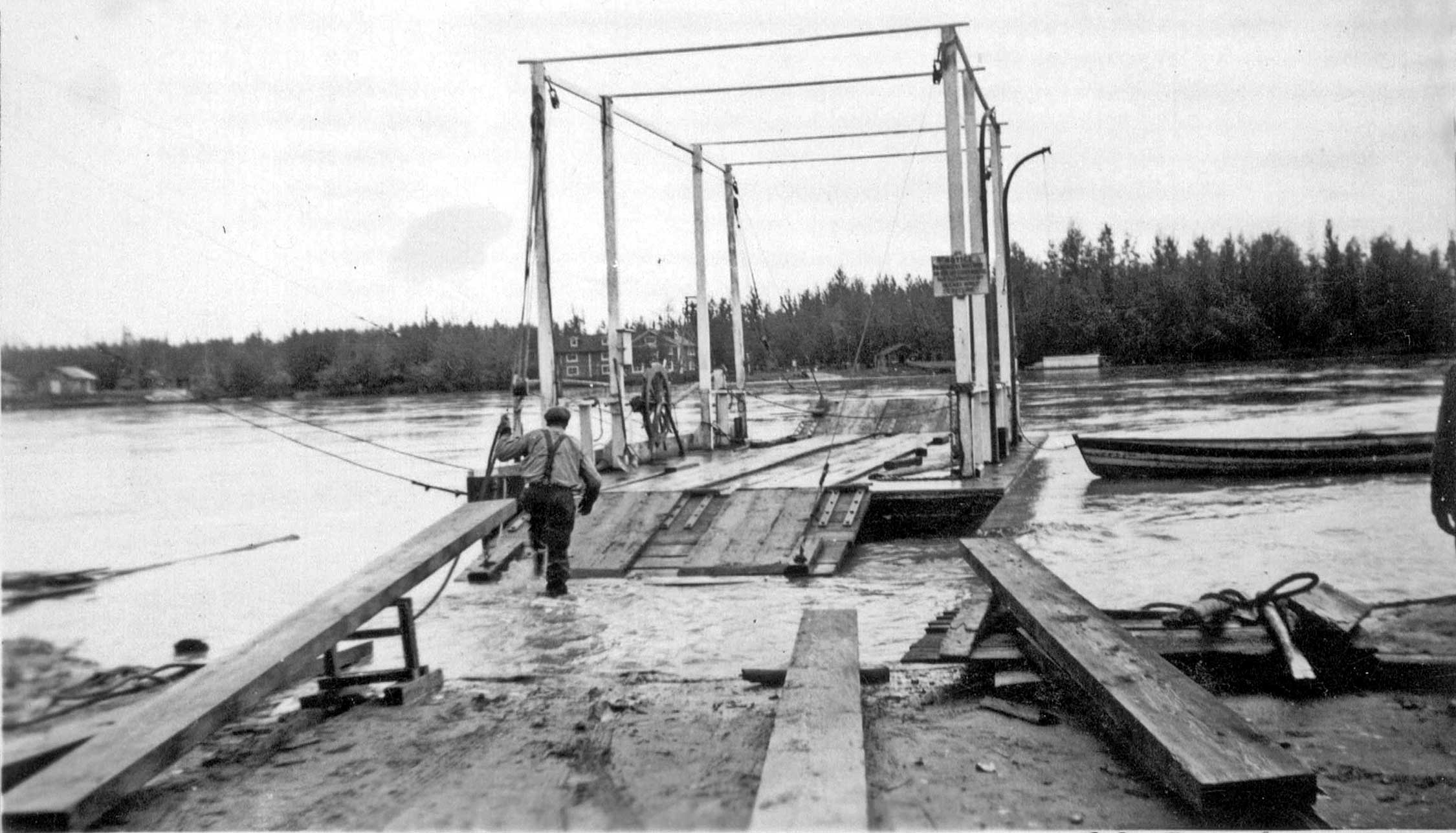 McCarty Landing ferry on the Tanana River, part of the RIchardson Road, Big Delta, Rika's Roadhouse in background. --Laurie Nyman Collection The traveler will find primitive, mainly one-story log road houses all the way to Richardson, 204 miles from the Edgerton cutoff to Chitina. This hamlet rests uncomfortably along the east bank of the Tanana, justifying its existence as a riverboat landing and a distribution point for the mining settlements of the area. A large two-story log roadhouse, two smaller roadhouses, a general store and gas station are all there to leave the impression that Richardson really is a town. This writer was not impressed. Due to very boggy conditions south of Shaw Creek we arrived late in the afternoon at the Tanana crossing of McCarty. This name is not to be confused with McCarthy. The cable ferry crossing leads to the U.S. Army telegraph station near the Big Delta Roadhouse. The roadhouse was until recently operated by the well-known John Hajdukovich. He transferred the property to Rika Wallen. We took overnight accommodations at Rika’s lodge which looks upon a rocky bluff of the Tanana River, but fails to have a scenic view of the mountains. From Rika’s, the Alaska Range appears to be very close. We’ve already traveled about 100 miles, but still have another 200 miles to go before reaching Copper Center.The most distinctive feature in the area is the large rounded Donnelly Dome. Just beyond the dome looms the Alaska Range at its most majestic, with a series of eternally snow-covered peaks. The boggy trail at the base of the range leaves a high plateau just beyond the dome and begins to follow the Delta River upwards into the mountains. Black Rapids Roadhouse and trading post at mile 227 is yet another rambling one-story structure, but it boasts a great view of Black Rapids Glacier. This stop was once a horse exchange point, but those days are, thankfully, behind us now. Although there were some spruce trees in the immediate area, the lodge appears to be near the top of the tree line. The surrounding rugged valley walls are completely bare and rust-colored. We heard of numerous placer mining operations in the vicinity. 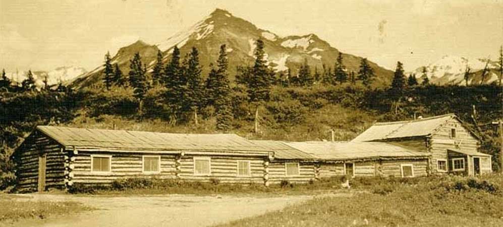 Black Rapids Roadhouse on the Richardson Trail From this point on through the mountains, the stream crossings present the greatest obstacle, and bridges are non-existent. Fording can be hazardous, but by mid-summer most the streams run very low water. Many rock slides cover the trail. At mile 203 we had reached the summit of the Alaska Range. Yost’s Roadhouse, also known as McCallum’s, once operated at the high altitude of nearly 2900 feet Still remaining are a few leaning log structures through which the cold winds appeared to blow almost without relief. This is a very desolate, treeless, but surprisingly beautiful area. Old glacial moraine can be seen everywhere. At this high point, appropriately called Summit Lake, we were at the headwaters of the Gulkana River, placing us in the far northern end of the Copper River valley. Paxson’s Roadhouse at mile 185 was a most welcome sight. It sits in a location sheltered from the wind and consists of a two-story Hudson Bay style log building with a 120-foot-long horse barn. The lodge marks the junction to mining camps at Valdez Creek in the west and Slate Creek toward the east. 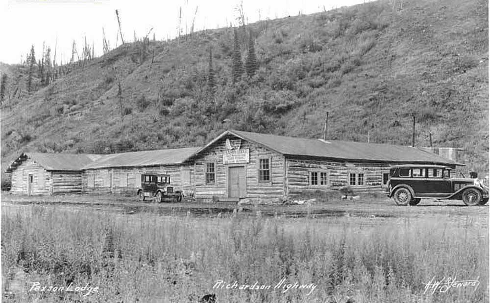 Paxson Roadhouse on the Richardson Trail When we arrived at Sourdough Roadhouse at mile 147 we knew we were getting close to our night-time destination of Gulkana Roadhouse. Sourdough is a main Orr Stage Line point with numerous outbuildings, but no view. Another ten miles down the road is Poplar Grove Roadhouse. It consists of a small two-story structure with a single-story structure nearby. This area was particularly boggy and mosquito-infested. At mile 127 is the sizable Gulkana Trading Post and Hotel. It is at the junction of the Eagle and Susitna Trails. The log building overlooks the Gulkana River near its confluence with the Copper. It is one of the few lodges with a spectacular mountain view, looking toward Mt. Sanford and Drum of the Wrangell Range. Mrs. Griffith, the proprietor, informed us that she had just purchased Kenny Lake Roadhouse near Chitina. We passed Dry Creek at mile 117. The roadhouse was one of the many deserted ones which already seem to exist everywhere along the trail. This one was a badly-leaning, two-story log structure. Nearby was a small Native camp. Not far beyond the road drops down a steep hill into the Tazlina valley. An abandoned roadhouse near the river served until recently as one of those obsolete horse-changing stations. James L. Simpson, the last owner, found more money in trapping the Tazlina valley than working the lodge. It recently joined a growing list of abandoned lodges as the summer of 1923 approaches the fall. 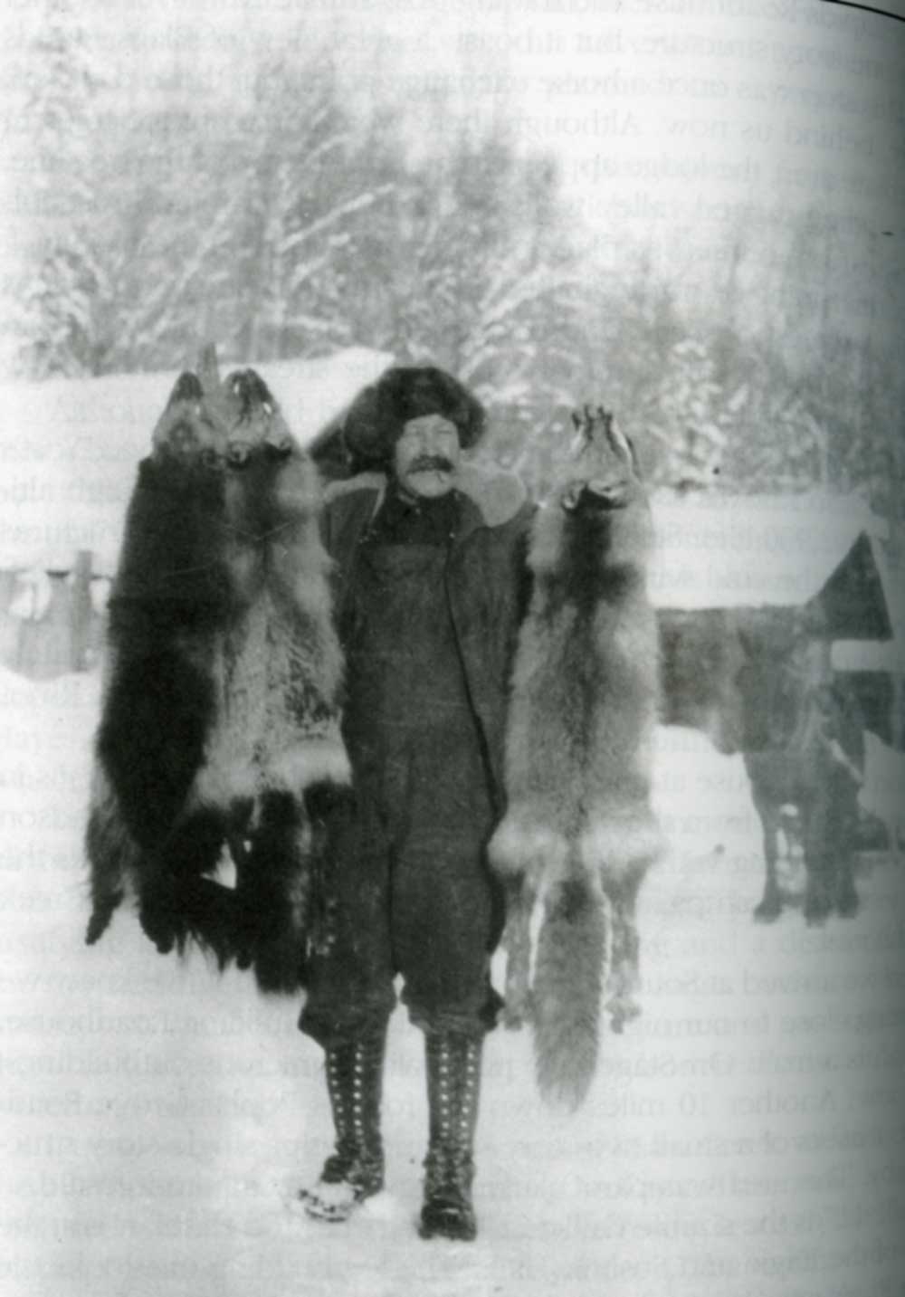 James L Simpson, trapper & horse stable operator, possibly at Tazlina The Copper Center Roadhouse and Trading Post at mile 101 is the former Hotel Holman and Trading Post, also known as Blix’s Roadhouse. It is now operated by Florence Barnes. We passed by a primitive Indian school and a dusty Native settlement north of the lodge. The remains of a government agricultural station and a fox farm just upriver from the lodge were among the growing number of deserted buildings. On the south end of Copper Center, the Klutina River crossing consisted of two bridges with an island in the middle of the river. |
No comments:
Post a Comment