| The Wrangell Formation, Pt 5, conclusion |
| Wesley Dunkle -- Chapter 2 of "Legacy of the Chief" |
Dunkle looked straight at Johnny, who smiled slightly. Outside it was getting dark. The sun was giving way to city lights. He paused to take a drink of water from the pitcher set on the desk beside him.
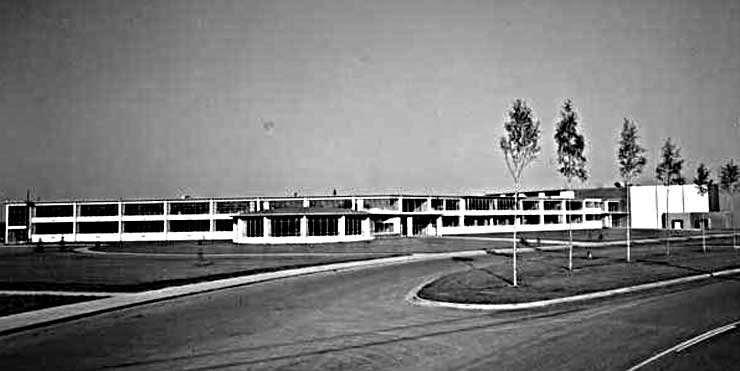 |
| Anchorage High School (West High) in 1956--where the lecture would have taken place |
| This is all I have left now. I offer the past. I am the past. Even Johnny over there represents the past. We are not really part of this post-war world, unlike these much younger people. Like the twilight outside I represent something which is rapidly vanishing. So does that Native, even though he is much younger than I. |
“In any case, these lava flows filled the rift-formed basin and were subsequently covered by warm, shallow, tropical seas. Many layers of sediment, primarily from coral reefs, deposited as marine-based limestone. Most important was the Chitistone limestone. Within the Chitistone formation was a dolomite limestone which became the favorable host rock for the high-grade copper deposits which would follow. Other sediments which were deposited above and below this layer included both limestones and shales. The name Chitistone comes from the Ahtna word chiti, which means copper, because the rich copper deposits are found only in the Chitistone limestone.”
“Tsedi.”
“What?”
“We call it ‘tsedi,’ not ‘chiti,’ but we found out long ago that you non-Indians have a way of corrupting our language.”
“Thank you, Johnny. I didn’t realize that. But I’m not all that surprised at what you are saying, either.
“Where was I? Oh, yes. Over the last 200 million years this terrane gradually worked its way north, riding on the back of the highly fluid and northwesterly-moving Pacific plate, until it finally welded itself into the area extending from what is now British Columbia all the way into south-central Alaska. Other terranes followed this route. These were the composite terrane and the Yakutat terrane.
“The strong subduction caused by the action of the Yakutat terrane slipping under the composite and Wrangellia terranes no longer produces as much volcanic activity as it had originally because the strike-slip movement of nearby faults have started to absorb much of the stress caused by the ongoing actions of the Pacific plate and all the terranes which ride on this plate. Instead we have increasing seismic activity in the area. This slowing down of the volcanic processes only began in the last 200,000 years. While the process of the building of volcanoes appears to be over, the possibilities for massive earthquakes in the area appear to be increasing. All that energy caused by continuing subduction has to go somewhere. My guess is that considerable stress is building up within the fault zones which could ultimately result in massive earthquake activity in the area, but that is another matter.
“As to the volcanoes, the only active one left is the youngest of these, which is known as Mount Wrangell--a huge shield-type volcano which has been formed by a gradual building up of lava flows rather than by erupting, fast moving, and highly explosives lavas. Mount Wrangell and the older Mt. Blackburn to the east, are the closest large geological features to Kennecott , but their existence did not contribute directly to the formation of the famous copper deposits.
“Because the area is characterized by rapid erosion, the older volcanoes have lost their original shield-like shapes. They have been worn down by unrelenting glacial action and other processes of erosion which occur almost as quickly as the mountains form. The rapid process of erosion caused the early exposure of copper ore to the water and air.
“The early basaltic flows of 200 million years ago which included the Nicolai greenstone also contained the coppers that were settled out to a composition of less than one-tenth of one percent within the greenstone. This is too weak a concentration to have any economic value, yet it is this greenstone which is the ultimate source of the copper in the region. On the other hand, the native copper which formed south of the Nizina River, though not economically important, includes some very large nuggets weighing thousands of pounds. One of them still rests at Chitina. It was brought in from the Chititu area. A larger nugget found at Dan Creek is now at the University of Alaska in Fairbanks. No such nuggets are to be found in the greenstone of the area where the Chitistone copper formations exist.
“When the shallow warm seas formed over the early basalt flows, coral reefs built up a succession of deposits of limestones and shales that settled over the greenstone, as I already said. After the Wrangellia Terrane moved into its present position the sublimation resulted in uplift, tilting and folding of these layers. This process continued until the Chitistone formation ended up with an average tilt of twenty-three to thirty-three degrees. The Chitistone formation was heavily fractured and faulted by the same process.
“Some very early volcanic activity resulted in the creation of a dome of hot molten porphyry that was appropriately named Porphyry Mountain. This is the large mound to the immediate south of the Bonanza Ridge and just to the northeast of McCarthy. Porphyry dominates the landscape to the east of the small town. Limited prospecting in the basalt dome revealed no minerals of any real value.
“This local formation process at Porphyry was a very violent one. The volcanic activity around Porphyry intruded large amounts of hot molten lava into the earlier formations. The magma heated the circulating brine waters that sought the copper out of the underlying greenstone. It concentrated the copper and forced it through the faults and fissures into the overlying Chitistone limestone.
 |
| Porphyry Mountain as seen from the Bonanza Mine |
“The dolomite limestone layer occurs fifty to seventy-five feet above the contact point between the greenstone and the overlying limestone formations. As I pointed out, it proved to be the congenial host rock. The dolomite limestone had the right type of physical and chemical composition to enable it to be readily replaced by the concentrated copper deposits. The deposits followed along the fractures, breccia and fault zones into the dolomite limestone, settling as heavy, rich deposits of predominantly sulfide coppers. The sulfide results from the organic remains of the coral. The copper has been referred to as a replacement deposit, since it forced its way into the dolomite and widened the faults and fractures by dissolving the immediate limestone and then filling the resulting openings with the rich deposits.
“Thus the existence of Porphyry Mountain at the lower end of the Bonanza Ridge became the key to the whole process. The richest and heaviest concentrations of copper tended to occur in the dolomite limestone which was closest to the porphyry dome. The farther one gets from the porphyry, the less likely it is that copper of significant concentrations will occur.
“Oddly enough, the richer Kennecott copper deposits were not the ones closest to the mountain. Bonanza Ridge extends from Root Glacier on the northwest, heading southeast until it meets Porphyry Mountain. The closest Kennecott mine to Porphyry Mountain is the Bonanza, followed by the Motherlode, then the Jumbo, and finally the Erie. The richest high grade copper was found at Erie while the lowest occurred at Bonanza and Motherlode. The Green Butte mine deposits to the east of this porphyry was a direct beneficiary of this process as well, though its deposits did not compare in quality or quantity to the massive ones of the Kennecott claims.
“With the volcanic activity of Porphyry Mountain the necessary geologic factors were brought together in this one relatively small and unique area to produce the Kennicott Formation. What had originally appeared to be great promise for the district as a whole was really limited to copper deposits existing only within Bonanza Ridge because the formation process was so localized.
“Because the layers of Chitistone limestone were already tilted to an average of thirty degrees, the copper was deposited along this incline at a distance of about fifty to seventy-five feet above the underlying greenstone at the same angle. While the greenstone is the source of the copper, it appears to contain no economically-significant deposits.
To repeat, the point where the Chitistone formation rests on the Nicolai greenstone is called the contact zone. The contact zone is readily apparent from the surface due to an obvious change in color, but the bedding plane of the copper rests fifty to seventy-five feet above this contact zone at an average angle of thirty degrees.
“Rapid erosion almost immediately began cutting into this new formation once it rose above sea level. The process of oxidation began when ground water and air came into contact with the exposed copper sulfide deposits. The oxidation stopped abruptly when a prolonged period of glaciation overwhelmed the area. As mechanical erosion resumed with the subsiding of the glaciers, the ore which was exposed occurred mainly as an unaltered chalcocite which is the copper sulfide, as well as lesser amounts of carbonates, which is the copper altered by the earlier process of oxidation. This proved to be an important consideration in Kennecott’s design of the mill since the carbonates do not mechanically separate from the host rock as well as the sulfides.
“Kennecott brought up a young engineer named E. T. Stannard who developed a unique ammonia leaching process which proved to be the key to separating the carbonate coppers from the dolomite limestone host rock. The ammonia leaching plant was the first of its kind and worked very well once we combined it with a good water flotation process. Stannard later went on to become president of Kennecott, succeeding the founder, the great Stephen Birch himself.
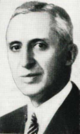
E.T. Stannard
“Kennecott is a company of engineers. The company has always relied on a number of consulting geologists such as myself. We have a term called economic geology. It is a study of the various geologic factors in and around a mineral deposit which is then used as a guide to the evaluation, development and working of a mine system. We entered a country where we had no experience when we tackled the sub-arctic region of Alaska. We spent many years developing a base of knowledge for this area. A correct interpretation of the minerals and their surrounding environment is essential for the successful discovery of ore veins and the proper development of the mine itself.
“It took a number of years before we determined just how unique our deposit was and that only the type of copper veins found at Kennecott could be worked profitably. The geologic combination of factors which made these deposits possible is so unique that similar deposits have, to my knowledge, never been found anywhere else in the world.
“Unfortunately, this also meant no where else in the Copper Valley region would a similar deposit be found. Thus, once this one group of mines owned by Kennecott was worked out, there would be nothing else left in the valley of this type to mine. When Kennecott was worked out, the district as a whole would be finished.
“Still, if I was a young man, I would want to further explore the Wrangells in the admittedly remote hope of finding yet another significant deposit--whether it was copper, gold, or some other mineral.
 |
| Chief Goodlataw |
“There was also the native copper I alluded to, which existed in greater concentrations in the greenstone to the south side of the Nizina River. These were found as nuggets as revealed in the small streams which cut through the area. It was largely this copper which the Ahtna Indians used to fashion tools and hunting implements. None of it proved of interest to Kennecott.
“The most impressive copper was found by the Ahtnas at the Nicolai Prospect, which is on the southeast end of the Kennicott Formation. This particular outcropping consisted mostly of malachite stains on copper sulfide. This small, but spectacular outcropping wetted the appetites of those early prospectors who sought the mother lode of copper. Thus the great Bonanza copper outcropping--just two ridges away--awaited its discovery. Along with the Bonanza existed the adjacent Jumbo vein and the Mother Lode itself. In this one case at least, there really was a mother lode.
“Just imagine! It all began because of a mysterious humble Indian chief we know only as Nicolai the tyone of Taral. I have often wondered what he must have thought when he realized the magnitude of the human tidal wave he set off with his Nicolai Prospect.”
Continue with
"Closing Day at Bonanza"
Continue with
"Closing Day at Bonanza"
No comments:
Post a Comment