Map of the Rail Lines of the Klondike District

Map showing the two coal mine short lines down the Yukon River from Dawson (click). Room permitting, these will both be included in the final Phase III plan, possibly in the configuration shown below. Click above map for a larger version.
Forty-Mile was the first gold-rush town in the Yukon, preceding the Klondike Gold Rush by several years. Here you see it in one possible version of a narrow gauge model RR line I drew up in 2007. This is the most inclusive version, including the major rivers & waterways associated with these four railway systems, plus the towns of Grand Forks, Klondike City, Dawson City and Forty-Mile. The townsites on the map are bounded by gold lines. The major drawbacks to this layout are the waterway set-up and the huge amount of space required in order to build a credible model historic railway system. This version will probably never be constructed, but it was under consideration at one time here at the CRD.
Forty-Mile was the first gold-rush town in the Yukon, preceding the Klondike Gold Rush by several years. Here you see it in one possible version of a narrow gauge model RR line I drew up in 2007. This is the most inclusive version, including the major rivers & waterways associated with these four railway systems, plus the towns of Grand Forks, Klondike City, Dawson City and Forty-Mile. The townsites on the map are bounded by gold lines. The major drawbacks to this layout are the waterway set-up and the huge amount of space required in order to build a credible model historic railway system. This version will probably never be constructed, but it was under consideration at one time here at the CRD.
In 2010 I completed the model railroad as far as the site of the Sulphur Springs wye. I will probably ultimately continue it on as far as Grand Forks. The White Pass extension, shown in red, is in a different configuration than that seen on the map below because it is connected to the existing CRD mainline.

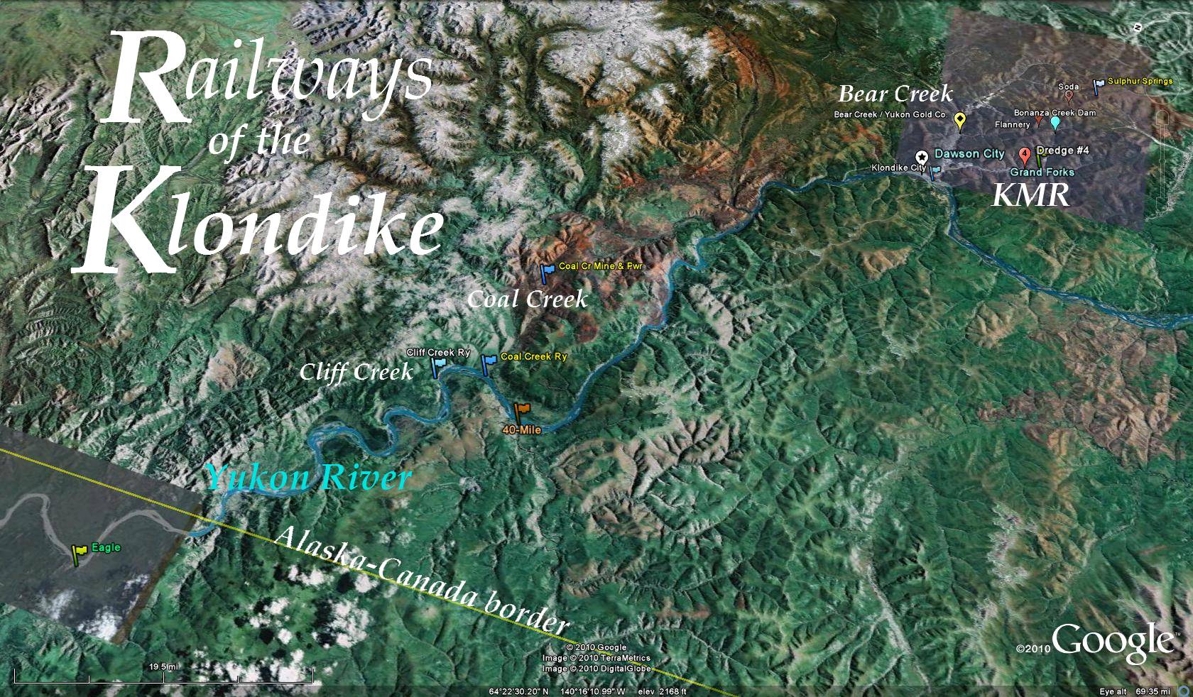
Google-Earth map showing the geographic layout of the Coal Creek-Forty-Mile area and its relationship to Dawson City and Grand Forks. Click this map for a larger version.
No comments:
Post a Comment